
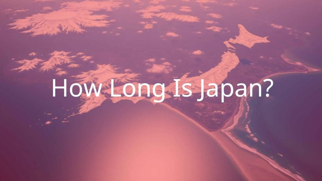
Japan is a country made up of many islands, located along the Pacific coast of East Asia. People often think of its crowded cities and peaceful scenery. But just how long is Japan? The country covers about 377,974 square kilometers (145,937 square miles), putting it among the world’s largest island countries. However, the length of Japan stands out much more than its width. The country stretches more than 3,000 kilometers (about 1,900 miles) from the Sea of Okhotsk in the north down to the Philippine Sea in the south. This long shape has a big effect on its weather and cultural differences in different regions.
If you compare Japan’s length to the eastern United States, it would reach from central Maine down to Florida. Despite its length, Japan is quite narrow-nowhere is it more than 150 kilometers (93 miles) from the sea. This makes Japan’s geography unique, affecting its history, nature, and where people have settled.

How Long Is Japan from North to South?
Japan’s long stretch from north to south is one of its main features, helping make its climates, plants, and local customs very different in each part. From Hokkaido’s cold north all the way to the warm islands of Okinawa in the south, Japan covers many types of landscapes and weather. This north-south shape helps define the country’s personality.
What Is the Total Length of Japan in Kilometers and Miles?
Altogether, Japan measures over 3,000 kilometers (about 1,900 miles) from its northern tip to its southern edge. This is because the country formed along a line of volcanoes, showing the active nature of its geology. The measurement includes the four main islands as well as lots of smaller, outlying islands that reach into different climate zones.
It’s worth noting that Japan isn’t a single stretch of land-it’s a chain of islands. Each island adds to the total length, but has its own look and feel. This setup also brings certain challenges for travel and connecting different areas, making regional development unique.
Which Points Mark the Northernmost and Southernmost Tips of Japan?
Defining Japan’s exact top and bottom points can be tricky because of some disputed territories. Focusing on areas everyone agrees on, the northernmost point is Benten-jima in Hokkaido at 45°31′38″N. This small island sits in the La Pérouse Strait by the Sea of Okhotsk.
The southernmost point that is not disputed is Okinotorishima, a little coral atoll in the Philippine Sea at 20°25′31″N. This isolated bit of land expands Japan’s maritime area and shows how far south the country reaches. These two points underline just how long Japan is from top to bottom.
How Does Japan’s Length Compare to Its Width?
Japan is very long from north to south but much narrower across. At no spot is the country more than 150 kilometers (93 miles) from the coast, which means the sea shapes much of the weather and way of life. The widest part of Japan is only about 270 kilometers. This shape, with mountains running down the center and cities mostly on the coasts, has affected travel, where people live, and how the country grew over time.
| Measurement | Distance |
|---|---|
| North-South (length) | 3,000 km (1,900 miles) |
| East-West (widest point) | 270 km (168 miles) |
| Distance from sea (max) | 150 km (93 miles) |
What Are the Main Islands That Make Up Japan’s Length?
Japan’s stretched shape comes from its string of islands. While there are over 14,000 islands that belong to Japan, just a few main ones carry most of the population, cities, and industries. These islands form the backbone that gives Japan its length.
Honshu: Japan’s Longest Island
Honshu is the biggest island in Japan and the longest, measuring about 1,300 kilometers (810 miles) long. More than half of all Japanese people live here, along with important cities like Tokyo. Honshu covers a lot of ground, from snowy mountains to crowded cities, and sees a wide range of weather. Its long, thin shape lets it have both cold and warm weather at either end, with a big mix in between.
Hokkaido: The Northern End
At the far north is Hokkaido, Japan’s second-largest island. It has long, cold winters and cool summers and is less crowded than Honshu. Hokkaido is an important farming area and is joined to Honshu by a tunnel under the sea, helping people and goods move smoothly between the two islands.
Kyushu and Shikoku: The Southwestern Stretch
Going south from Honshu, you reach Kyushu and Shikoku, the next main islands. Kyushu is best known for its volcanoes and warm climate, and has long been a bridge between Japan and the rest of Asia. Shikoku, smaller than Kyushu, is just south of Honshu and separated by narrow straits. Both islands have their own weather and culture, and together they highlight just how long and varied Japan is from north to south.
Okinawa and Remote Southern Islands
The length of Japan does not stop at the main islands. Okinawa Prefecture and the far southern islands, like the Ryukyu and Nanpō Islands, stretch more than 1,000 kilometers (620 miles) farther south. These southern islands have warm winters and hot, wet summers, making them feel almost tropical compared to the north. Some of these islands are close to Taiwan, and places like Okinotorishima extend Japan’s reach far across the ocean. Their location also means lots of different plants and animals live there.

What Is the Total Length Including Outlying Islands?
Counting all its islands, big and small, Japan reaches over 3,000 kilometers (1,900 miles) from top to bottom. In 2023, a new survey even raised the total number of Japanese islands to over 14,125. The outlying islands, including those that are uninhabited, give Japan one of the biggest ocean territories in the world, and they help shape its climate and wild life.
| Island | Approx. Length (km) | Main Region |
|---|---|---|
| Honshu | 1,300 | Central/Mainland Japan |
| Hokkaido | 500 | North |
| Kyushu | 300 | Southwest |
| Shikoku | 225 | Southwest |
| Okinawa & Ryukyu Islands | 1,000+ | Far South |
What Are Japan’s Extreme Points?
Japan’s shape means it has clear points that are its furthest in each direction-north, south, east, and west. Some are still argued over, but many are generally agreed upon. These endpoints show just how wide a part of the Pacific Japan covers.
Northernmost and Southernmost Islands
- Northernmost (undisputed): Benten-jima, Hokkaido.
- Northernmost (disputed): Cape Kamoiwakka on Etorofu (disputed with Russia).
- Southernmost: Okinotorishima, Coral Atoll in the Philippine Sea.
Okinotorishima is especially important because it lets Japan claim a large ocean area nearby. Not all of these edge islands are easy to get to, but they help define Japan’s size.
Easternmost and Westernmost Limits
- Easternmost: Minami Torishima (Marcus Island), in the Pacific Ocean.
- Westernmost: Yonaguni, in Okinawa Prefecture, close to Taiwan.
| Direction | Point | Location |
|---|---|---|
| North | Benten-jima | Hokkaido |
| South | Okinotorishima | Philippine Sea |
| East | Minami Torishima | Pacific Ocean |
| West | Yonaguni | Okinawa Prefecture |
How Does Japan’s Geography Influence Its Length?
Japan’s long shape comes from powerful natural forces. The country sits near several moving sections of the earth’s crust, called tectonic plates, and this has shaped its islands into a long, narrow group.
Island Arc Structure and Tectonic Plates
Japan is an “island arc,” made as ocean plates push underneath land plates, causing volcanoes and earthquakes. The country is at the meeting point of the Okhotsk, Amurian, Okinawa, Pacific, and Philippine Sea Plates. This has pulled the islands out into a long line and created deep ocean trenches nearby. The land is still changing today, with quakes and eruptions being common.

Major Mountains and Coastal Features Along Japan’s Length
Around 73% of Japan’s land is mountains, which run mostly along the middle of the islands. The “Japan Alps,” with peaks over 3,000 meters high, run for much of Honshu’s length. These mountains split the islands into different weather zones: the Pacific side is often sunnier, while the Sea of Japan side gets heavy snow. The coastline differs too, with natural ports more common in the south. This landscape plays a big role in how people live, travel, and farm.
How Is Japan’s Length Important Culturally and Geographically?
Japan’s extended length does more than make it look interesting on a map-it affects everything from the weather to food, traditions, and even how people talk.
How Does the Length Affect Climate and Natural Zones?
In the north, Hokkaido has long cold winters and lots of snow. In the far south, places like the Yaeyama Islands are hot and get a lot of rain, with tropical plants. This mix lets Japan have many kinds of crops, different ways of building houses, and unique local festivals all across the country.

Regional Differences Across Japan’s Length
Japan’s different regions all have their own foods, dialects, and customs, thanks to the long distances and mountains separating areas. For example, Hokkaido is known for dairy and seafood, while Okinawa cuisine is influenced by nearby Asian countries. Even clothing, buildings, and celebrations change from one region to another, all reflecting the local climate and available resources.
Impact on Transportation and Travel
Traveling across Japan’s long shape can be a challenge, but the country has built a very good transport system. The Shinkansen, or bullet train, runs from northern Honshu down to Kyushu, and soon even further into Hokkaido. Highways, flights, and ferries connect the different islands. Huge bridges and the Seikan Tunnel help people and goods move easily, almost making it feel like one big landmass.
| Travel Option | Main Route | Approx. Time |
|---|---|---|
| Shinkansen (bullet train) | Tokyo to Hakodate | 4-5 hours |
| Domestic flight | Tokyo to Okinawa | ~3 hours |
| Ferry | Kagoshima to Okinawa | 25 hours |
Common Questions About the Length of Japan
Japan’s unusual length leads to many questions about how it compares to other countries and how it affects life there. Here are some of the most common questions and answers:
Is Japan Longer Than the UK or Italy?
Yes, Japan is much longer than both the United Kingdom and Italy. While the UK and Italy are both known for long coastlines, Japan’s north-to-south distance of over 3,000 kilometers is much greater. For example, Honshu alone is bigger than the whole United Kingdom. This long stretch allows Japan to have a wider range of climates and cultures than many other places of similar size.
| Country | Max Length (km) |
|---|---|
| Japan | 3,000 |
| United Kingdom | 1,000 |
| Italy | 1,200 |
Is Japan’s Length Changing Due to Geological Events?
Japan is always changing a little bit due to earthquakes, volcanoes, and the movement of the earth’s plates. These changes are slow but real. For instance, after the 2011 Tōhoku earthquake, parts of northeastern Japan moved more than two meters closer to North America, and some land actually widened. Sometimes new islands form from volcano eruptions, while others get smaller due to erosion. Japan’s total length generally stays about the same, but the details are always changing.
How Long Would It Take to Travel the Full Length of Japan?
You could travel Japan’s full length-from the north of Hokkaido to the southern part of Okinawa-in just a few days if you use only fast trains and planes. However, if you want to stop and enjoy different places and regions along the way, seeing cities, parks, and local events, it could take you weeks or even a month. The country’s transport systems make it easy to plan and take such a trip, letting you see the wide mix of weather, culture, and scenery found from one end of Japan to the other.

So, if you’re planning a trip to Japan anytime soon, do exactly that - plan! Read up on all of the amazing things to do here to make the most of your time. I can bet that you’ll still return home feeling like you could’ve explored much more.
- What Is a Maiko? - July 13, 2025
- What Does Domo Arigato Mean? - July 12, 2025
- What Does Naruto Mean? - July 12, 2025


